
 CC SA-BY Our Oakland
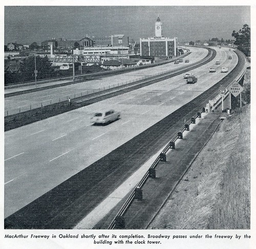 From California Highways and Public Works, July-August 1962. The original highway designation was Interstate 5W. Note The Saw Mill building, still with its tower.
The MacArthur Freeway (Interstate 580, I-580 or simply 580) runs 12.4 miles in Oakland, roughly tracing the base of the Oakland hills from the San Leandro City limits to the San Francisco-Oakland Bay Bridge approach.
Nearly 1.5 million dollars was spent landscaping the freeway, which was completed in 1966, and it was awarded first prize in the United States Department of Transportation's Second Annual Highway Beauty Awards Competition in 1969. In 1970, the MacArthur Freeway was included in the State Scenic Highways System by an act of the State legislature.
At the time of construction, citizens rallied to the cause of banning trucks on the 8.7-mile long segment of I-580 between Grand Avenue and Foothill Boulevard in San Leandro — and the federal and state governments agreed to the restriction, in part because there was an existing truck ban on the existing highway in the corridor, MacArthur Boulevard.1 This truck ban, which remains in place today despite occasional attempts to have the restriction lifted, is one of the reasons the parallel section of Nimitz Freeway is considered to be unsafe.
 Truly special.Route Description
The views from the highway, although not spectacular, are continuously satisfying. At the Western end of the route, the motorist can see across Mosswood Park, the Rockridge neighborhood and the City of Berkeley up into the hills. To the south rises downtown Oakland, and the observant traveler can spot Lake Merritt. Passing Mills College the motorist can sense the dirt roads and native vegetation that once determined the configuration of Oakland. The juncture with the Warren Freeway (Route 13) is visually clued by the plane cut through the hills. At the eastern end of the MacArthur Freeway the motorist travels tangent to the rhyolite hillsides which appear to rise from the roadbed itself. The pines along Foothill Boulevard create an attractive edge effect, lining the freeway with mature forty foot specimens. Hailed by an enormous American flag, mysterious for its size, but in fact hoisted from the gas station at Foothill Shopping Center, the driver approaches the San Leandro City limit. (From Scenic Highways, a 1974 report published by the City of Oakland.)
...interested in learning more about impressive views of highways in Oakland?
 CC SA-BY Our Oakland
Links and References
- Special Route Restriction History - Route 580, Caltrans (dot.ca.gov)

